By Marcus Holloway, Aussie Beat. 18 September 2026 – 12: 30 PM
Marcus Holloway writes on climate, weather and how they affect life around Australia.
Every few years the phrase “El Niño” turns up in the news and a familiar mood follows. Bushfire footage. Cracked earth. Dam levels. Someone on the radio saying it could be the worst on record.
I understand why. Some El Niño summers in this country have been genuinely awful. But the coverage tends to flatten a complicated thing into one simple message — it’s going to be hot and dry — and that’s not quite what the forecast is saying this time.
The Bureau of Meteorology has confirmed a strong El Niño is now firmly established across the Pacific, with ocean indices suggesting it could rank among the strongest on record. That part’s real.
What comes next is where it gets more interesting.
A strong El Niño doesn’t guarantee a disaster summer
This is the point meteorologists keep making, and the point that keeps getting lost.
Raw El Niño strength doesn’t automatically translate into unprecedented drought or a nationwide heatwave emergency. Other climate drivers are in play, and the unusually warm seas around the continent are pulling conditions in different directions depending on where you are.
Think of El Niño as loading the dice rather than deciding the outcome. It shifts the odds. It doesn’t write the script.
I’ve found that framing helps, because the alternative — treating every El Niño as a guaranteed catastrophe — makes people either panic or tune out entirely. Neither is useful.
What the outlook actually says
Hotter than average, almost everywhere
This is the clearest signal in the forecast.
The Bureau’s long-range outlook points to above-average temperatures across most of the country heading into and through summer. Global ocean temperatures are sitting at record highs, and that combination — long-term warming stacked on top of an El Niño — raises the odds of extended heatwaves and elevated fire weather.
Note the wording there. Odds. Not certainty. But when the background temperature is already trending up, El Niño doesn’t need to do much heavy lifting to push a summer into uncomfortable territory.
Rainfall is where it splits
Here’s the part that surprises people.
South-eastern Australia — southern NSW, Victoria and Tasmania — faces a higher chance of below-average rainfall into late spring and early summer. A developing positive Indian Ocean Dipole adds to that, and it tends to pull moisture away from the south-east during spring.
So if you’re in Melbourne, Hobart or southern NSW, the traditional El Niño story broadly applies.
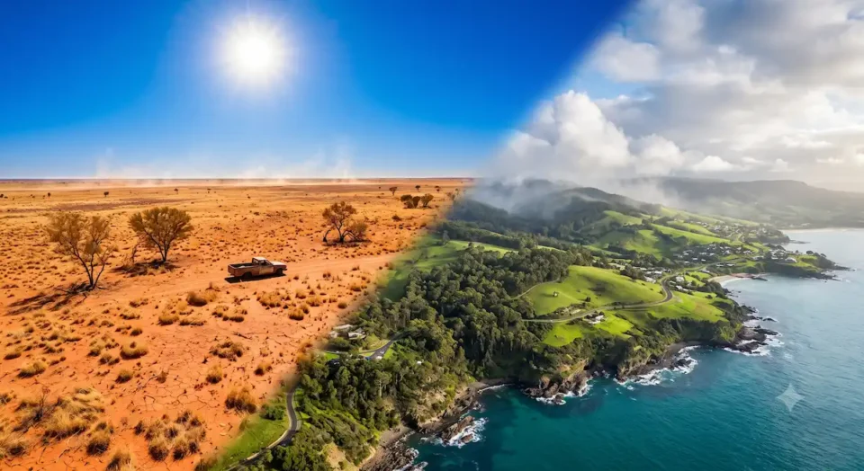
Western and northern Australia is a different picture altogether. Parts of WA, along with central and northern regions, are actually forecast to see above-average rainfall in coming months, driven by warm local waters feeding tropical moisture into the system.
That’s not a typo. A strong El Niño, and a wetter-than-usual outlook for a decent chunk of the country.
The humidity factor
Sea surface temperatures along the coast are running well above normal — around 2 to 3°C warmer than average in places, particularly off southern NSW, Tasmania and in the Coral Sea.
Warm water holds moisture. So while inland areas may get the dry, dusty version of heat, coastal regions could cop something stickier: humid days punctuated by short, intense downpours.
Anyone who’s spent a summer on the east coast knows the difference. Forty degrees inland is unpleasant. Thirty-four degrees with heavy humidity and no breeze is its own kind of misery, and it’s harder on the body than the number suggests.
The summary, in one table
| Factor | Outlook | What it means |
| El Niño status | Strong, intensifying | Established through summer and into autumn |
| Temperatures | Above average | More hot spells, higher fire weather risk |
| Rainfall (south-east) | Below average | Drier for Victoria, southern NSW, Tasmania |
| Rainfall (WA and north) | Above average | Wetter, with more storm activity |
| Water storages | Around 71% capacity | A reasonable buffer against early dry spells |
The water storage number is worth pausing on
Around 71% capacity is a genuinely decent starting position.
It doesn’t remove the risk — a long dry stretch will draw that down — but it does mean we’re not entering this summer on empty. Previous difficult El Niño years have started from a much weaker base, and that starting point shapes how quickly restrictions and stress arrive.
One thing I’d watch is how unevenly that’s distributed. A healthy national figure can conceal individual catchments doing poorly. If you’re in a regional area, your local storage number matters far more than the national one.
What this means practically
If you’re in the south-east
Plan for a dry, warm run. That means:
- Take fire preparation seriously and early. Not in December, when everyone else is doing it and the arborist is booked out for six weeks.
- Watch your garden’s water needs now rather than reacting when restrictions land.
- Check your insurance. Dull advice, I know. But reading the fine print in November is much better than discovering the gap in February.
If you’re in WA or the north
Don’t assume you’re off the hook. A wetter outlook still comes with heat, and storm activity brings its own problems — flash flooding, power outages, damage.
Above-average rainfall isn’t the same as a mild summer.
Everywhere, really
Heat is the one consistent thread across the whole country this season. It’s also, statistically, the natural hazard that causes the most harm in Australia, despite getting far less attention than fires or floods.
Basic stuff helps more than people expect. Knowing which room in your house stays coolest. Having a plan for elderly neighbours. Not scheduling physical work for the middle of the day when you don’t have to.
A note on forecasts generally
Seasonal outlooks deal in probabilities, and probabilities are easy to misread.
“Below-average rainfall likely” does not mean no rain. It means the odds have tilted. You can have a drier-than-average season that still includes a week of downpours, and people will reasonably ask what the forecasters were on about.
They weren’t wrong. The season was still drier overall. It just didn’t feel that way during the wet week.
It can depend a lot on where you are, too. Australia is roughly the size of Europe. A national outlook is always going to be a blunt instrument, which is why the local forecast matters more for actual decisions.
My honest read
I’d treat this as a summer to be organised about rather than alarmed by.
Strong El Niño, warm oceans, an existing warming trend — that combination raises the risk of heatwaves and bad fire weather in the south-east, and there’s no sensible way to spin that as good news. But the split rainfall outlook and reasonable water storages mean this doesn’t look like an automatic repeat of the worst years.
The thing that tends to go wrong isn’t the forecast. It’s the assumption that a headline about one part of the country applies to all of it. Check what’s actually predicted for your region, prepare accordingly, and ignore the more theatrical coverage.
Summers here are demanding at the best of times. This one asks for a bit more attention than usual.
